

YOU HELP SHAPE THE FUTURE
OF ROUTE 32
PROJECT BACKGROUND

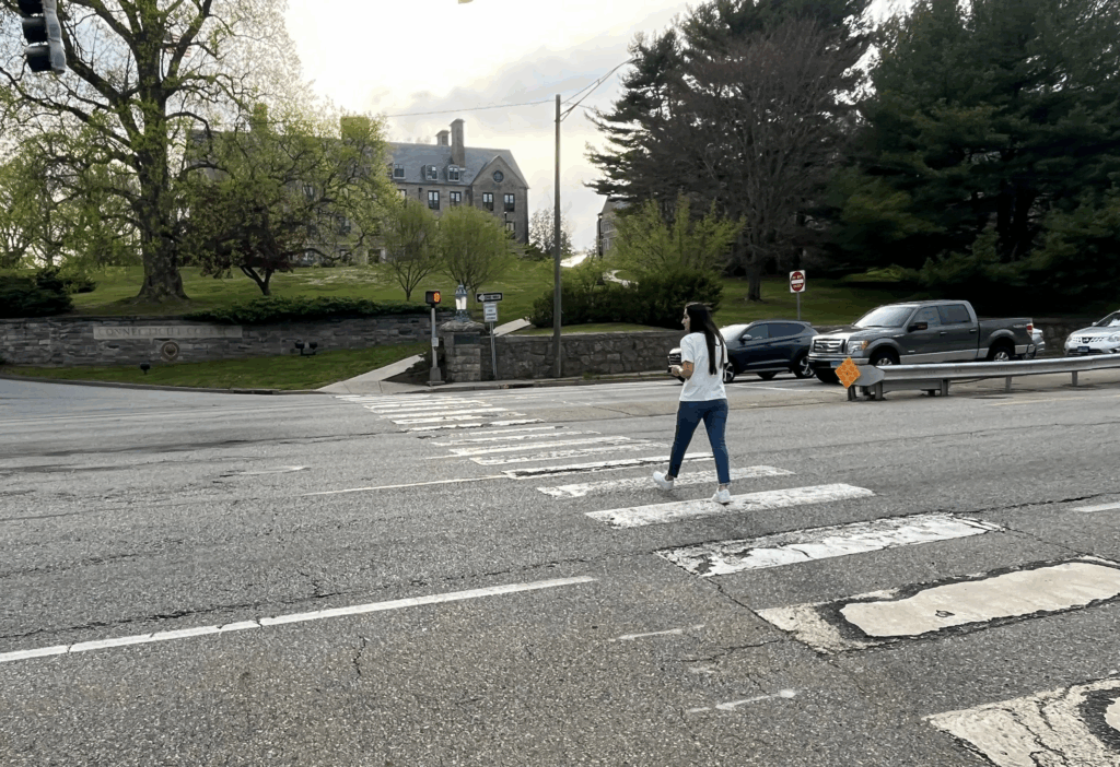
The corridor currently includes narrow, incomplete sidewalks and a concrete median barrier; there are few opportunities to cross while walking. Where there are crosswalks, they are long and uncomfortable due to having to cross four travel lanes and wide shoulders – many pedestrians and students choose to cross the roadway using the raised pedestrian bridge instead. There is no existing transit service or bicycling facilities provided along
Route 32.

In response to known safety challenges, the Southeastern Connecticut Council of Governments (SCCOG), in coordination with the City of New London and the Connecticut Department of Transportation (CTDOT), studied the corridor of Route 32 (Mohegan Avenue Parkway) from Williams Street to Benham Ave through the Connecticut College campus. This stretch of Route 32 provides access to the College, the United States Coast Guard Academy, and the Lyman Allyn Art Museum and is also an important regional connection to central New London from Norwich and other locations to the north. The intent of the study was to develop solutions that improve safety for all who live, work, and study in the surrounding areas – including people who walk, bike, take transit, and/or drive.
Through consultation with the community and local stakeholders, the study developed a vision for the future of the corridor and a long-term conceptual plan that addresses safety and provides a design for all modes of travel, including walking, biking, and taking the bus. A report of our findings and recommendations along with several conceptual drawings detailing what improvements are needed to create a safer environment for everyone is available below and on the Documents page of this website. This project is for conceptual design only, no timeline has been set for implementation.
PROPOSED COCNEPT PLAN
We have gathered input from the community on what changes would serve to improve the Route 32 corridor. A project vision has been developed to guide the development of a preferred concept.
VISION: Mohegan Avenue Parkway will serve to reduce barriers, create safe connections, and visually enhance the community through which it travels.
The proposed concept plan includes a landscaped median and a shared use path on both sides of the corridor to serve the campus areas. Two travel lanes in each direction are maintained, with left turn lanes provided at intersections and existing right turn lanes removed. View the proposed concept below (or click here to open the plan on a new tab).
Guiding Principles
- Transform Route 32 into a lower speed community street.
- Improve safety and comfort for all roadway users.
- Enhance connectivity across campus and to local destinations.
- Provide sustainable transportation choices for area residents.
- Establish a visual gateway into the College District through greenery, signage and public art.
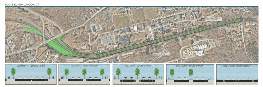
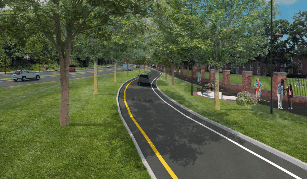
Perspective view, ramp from Williams Street
(looking Northbound)
Traffic calming measures are proposed for the on-ramp from Williams Street to slow vehicles approaching Route 32. This also creates space for landscaping enhancements and a potential rest area along the shared use path.

Existing
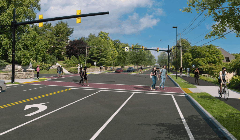
Perspective view, Connecticut College Main Entrance (looking Northbound)
An additional crosswalk is proposed at the college entrance with enhanced markings for added visibility. Signal equipment and lighting upgrades will help the corridor feel less like a highway and more like a community street.

Existing
Perspective view, approaching pedestrian bridge (looking Southbound)
Coming from the north toward the project area, an opportunity for enhanced signage is depicted to signal to drivers that they are entering the College Hill District. Trees along the sides and middle of the street will also help to provide a sense of enclosure to slow vehicle speeds.

Existing
Proposed
Proposed

Proposed
Project Timeline
We gathered input and data about how Route 32 operates today and what the existing challenges are, and gathered feedback on the preferred future concept plan. The final study is now available. This project is not yet funded and no timeline is set for implementation at this time.

